This map shows the paths from crossing the M4 to where the Ridgeway lies just south of Bishopstone and the path down into the village and the Royal Oak pub.
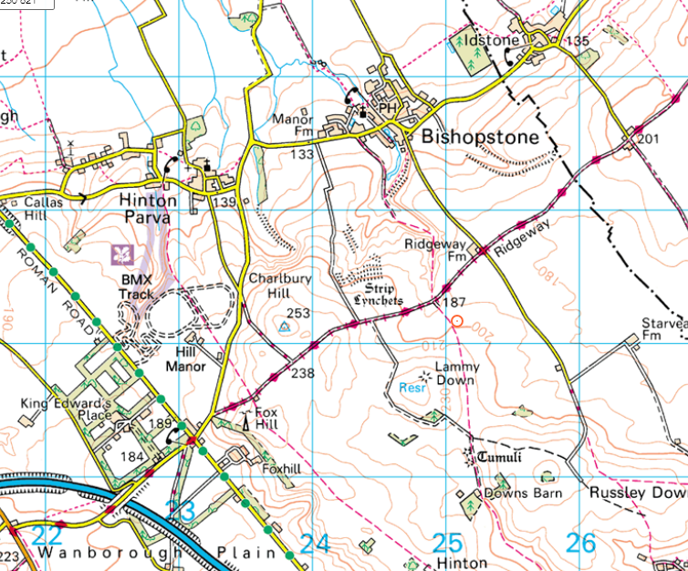 Click on the map to see it full size
This map shows the paths from crossing the M4 to where the Ridgeway lies just south of Bishopstone and the path down into the village and the Royal Oak pub.
Click on the map to see it full size
